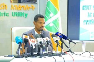
ADDIS ABABA – Ethiopian Geospatial Information Institute announced that it is developing an ecosystem that packages technology and policy framework aimed at sharing geographic information between governmental, non-governmental and private organizations.
The institute has been creating feasible condition to various organizations by feeding them with authentic latest geographic information in their activities to plan and apply national program, Institute Director General Tulu Beshah (PhD) said.
The development of the new ecosystem is important to produce and share geographic information that increases potential of organizations to plan and achieve national development goals, he noted.
The ecosystem is an efficient source of information that helps everyone from every corner of the country to get latest information from a single platform without personal presence, according to him.
The institute is also working to apply a technology that collects information from air installed in a plane. The information from this technology is significant to development of irrigation, water supply, and road and railway infrastructural facilitation, as to Tulu.
He said that the institute works on geographic location specifications intended to information networking to collect information significant for social, economic and climate preservation activities.
“We are working to develop the networks and the way we collect the information.” Accordingly, the institute is collecting photographs taken from air. In this regard, some 48 photographs that cover the total area of the country have been collected so far.
The photographs contained information essential for land registration, irrigation and power generation and other infrastructural facilities, Tulu said.
The institute has collected about 100, 90 and 50 percent geographic information in Amhara, Tigrai, Oromia and SNNPs states respectively in comparison to the area of the regions, he mentioned.
The institute is working to cover all states with photographic data collection to support the five year government development program with significant areal information, he expressed.
On the other hand, the institute is also producing topographic maps that are important to achieve annual plan of various ministerial offices including ministry of agriculture and house and urban development for indicating settlement, human and natural resources, and infrastructure, according to the Director General.
It is also analyzing satellite information to indicate the natural resource, and forest coverage as an input for strategic plan of organizations working on natural resource conservation, he expressed.
In the same token, the institute produces tourist maps that point out tourism destinations to ease tourists’ movement in the country. These maps are made to Afar, Amhara, Oromiaand SNNPs states. Currently, the institute is also preparing similar maps to signpost tourism sites in Dire Dawa and Harar areas, he pointed out.
Including the tourism sector, currently the government is undertaking various activities to revive the economy from the impact of global pandemic which the institute is also participating through providing information that will be publicized soon, it was learnt.
The Ethiopian Herald May 19/2020
BY YOHANES JEMANEH


