It is assumed that economic growth is interrelated with the expansion of infrastructures such as education, health, roads, transportation, and other economic sectors. But human development can’t be defined simply by stretching infrastructure; it rather emphasizes self-assertion, freedom of expression, well-trained human resources, and other values, which can be manifested by their intrinsic aspects.
To measure national development, systematic approaches and methods are needed so that effective and efficient outcomes can be obtained. Using multiple technologies, one can reduce fatigue and simplify the working environment.
He can also do things with no time and place constraints. The most promising achievements were scored based on the geospatial information. It is utilized as inputs for production, transporting, and consumption.
The parliament of the Federal Democratic Republic of Ethiopia has approved the proclamation for the re-establishment of the Ethiopian Mapping Agency as the Ethiopian Geospatial Information Institute. The institute was organized to support socio-economic development and ensure the well-being of citizens.
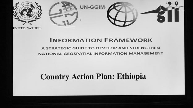
On the opening ceremony of the three days panel discussion on Integrated Geospatial Information Framework (IGIF) a country action plan recently, the Geospatial Information Institute Director, Tulu Besha (Ph.D.) said that geospatial information is vital and decisive for the social, environmental, and economic development. It also helps to defend a country and reduce pressures from regional, continental, and international security threats. Several types of research have shown the value and its advantages in this regard.
The Director remarked that the geospatial information can be labeled as a vital ‘digital currency’ as it helps to understand the availability of resources by answering quests such as what, where, when, in what quantity, why, and how through providing ample data. The information is submitted to decision and policymakers and other beneficiaries to take action. It can also be branded as ‘critical infrastructure’.
Tulu also pinpointed that in the current digital revolution, geospatial information coupled with communication and digital technologies play a key role to bring digital economic transformation through e-governance, e-service, and e-commerce.
The Director further explained that digital information technology and innovation have been evolving and contributed to modernizing service delivery. In the era of digital transformation, governments, policymakers, and beneficiaries easily get and use geospatial information to create and develop policies, standards, and technology welfare. These kinds of frameworks are progressing every time. There are a number of questions that can be answered by this framework including issues related to climate change, regional conflicts, and democratic setups.
Tulu also noted that countries are practicing the United Nations’ geospatial information framework which is adopted in 2019 to build strong and sustainable national geospatial data infrastructures. From 6 pilot selected countries, Ethiopia became the first to implement the framework. It took almost a year to prepare the country’s action plan and the institute with the collaboration of other stakeholders will start implementing the country’s action plan in 2014 mid-term. In the 2015 fiscal year, the institute plans to implement the country action plan which is going to be adopted by all stakeholders, organizations, and institutions which utilize geospatial information for their day-to-day business.
Tulu highlighted that Integrated Geospatial Information Framework has nine overarching strategic pathways. These are governance and institution, legal and policy, finance, data, innovation, standards, partnership, capacity and education, and communication and engagement. Its objective is enhancing and uplifting the nation’s geospatial information management, aligning the geospatial data with other social, economic, environmental, and statistical data. It also aims to connect other frameworks such as effective land management, global statistical and geospatial data integration framework, digital information strategy, and national leading scheme. The UN-led framework is designed to be implemented in every country to uplift a country’s geospatial information management; the Director further explained that geospatial information is inalienable with economic growth.
On the other hand, Dereje Mekonnen, Capacity Building Director at Geospatial Information Institute, said that the data gathered from space, air, and ground survey of geospatial information plays a vital role with regard to the social and economic aspects of the country. In order to achieve and score better out-come, countries need to equip themselves with technology and trained manpower. Jointly working also paves the way to achieve the goals.
The objective of the meeting according to Dereje is that to make geospatial information accessible through- out the country. Most organizations have their own geospatial information and utilize it based on their needs.
Currently in line with the UN geospatial framework, countries plan to have integrated information and make the data accessible and implement their national action plan. Different stakeholders should involve in implementing their action plan.
In addition, formulating policy-making, conducive legal frameworks, data, and networks with other stakeholders is vital.
Currently, the institute is working to make the integrated geospatial information in line with the national action plan and submit the plan to the responsible government body to be approved. In order to enhance its activities, it collaborates with different stakeholders including 34 institutions along with several universities. On the occasion, participants suggested their constructive ideas.
Dereje also mentioned that the prominent stakeholders attended the event. He said that every organization can be categorized as a stakeholder because it consumes geospatial information. The institute has worked with many stakeholders including the Ministry of Agriculture, Urban Development, Environment Protection and Development, and Biodiversity institutions. The geospatial information talks about facts on earth. Every organization including infrastructures schools, health centers, roads are part of the information because they have their own data which can be utilized as inputs for various purposes.
Around 85% of decisions all over the world are supported by geospatial data which serves as a cornerstone for decision making and a tool for development. Just like other stakeholders, the institute is in the process to use space science technologies.
In addition, Tulu said that in order to implement the framework, every stakeholder should feel that the information provided by the institute is its own and work hard.
BY DANIEL ALEMAYEHU
THE ETHIOPIAN HERALD NOVEMBER 11/2021


